Digital transition in citizen participation
The world today is digital. We use digital tools. We have access to real-time information basically about everything. We can influence and voice our opinions instantly online.
In this context, cities find it challenging to reach their citizens with traditional means. Thus, building cities together with citizens through citizen participation requires different thinking and also includes working with digital methods.
There is already a motivation from the cities’ side to invite ideas and open discussion around them from citizens before any decisions are made. It is also acknowledged that decisions should be made based on facts and actual up-to-date feedback from citizens.
Different digital platforms can be used as tools to organise and implement participatory processes with citizens. These platforms also provide the opportunity to increase the transparency of planning processes. Equally important is that data and insights of citizens are systematically collected, which requires the introduction of further digital tools.
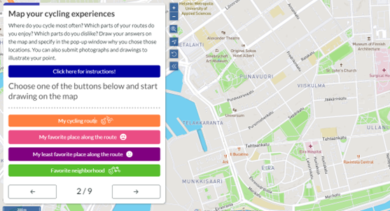
One of these tools is online map-based questionnaires which can help to tackle the three main challenges cities often face when starting a complex planning process:

First and second, cities face the challenge of reaching too few people and too late in planning processes as they don’t have enough resources to engage thousands of people through events or meetings. With online map-based questionnaires, many more people can be reached and much faster.
Thirdly, even if cities manage to reach a sufficient number of citizens and collect their input, they face the challenge of translating people’s knowledge into planning outcomes. By online map-based questionnaires it is easier to make people’s knowledge count as the data collected from citizens are already in such digital format which makes it possible to compare and analyse them with other types of data.
Why is this helpful for decision-making in cities?
In complex planning processes, cities need to use multiple knowledge to make better decisions and achieve real positive change in their cities. Therefore, it is crucial to find a way to combine people’s and expert knowledge.
Collecting data from citizens by map-based questionnaires at least opens up the possibility of making analyses jointly with expert data. But how can you implement such analyses? What should you do exactly with the experiential data gained by map-based questionnaires?
The answer is that these experiential data need to be shared and distributed inside the municipality among different departments by integrating them into the city-wide GIS system. GIS, being the abbreviation of geographic information system, is a framework for gathering, managing, and analysing data.
Most cities have already set up such GIS systems which usually include spatial data about plans and guidelines, services, livelihood, built environment, infrastructure, natural environment, and mobility.
The experiential knowledge can complete these datasets. This way planners, or other staff of the municipality searching data in the system, can also apply the layer developed from the data collected from citizens through the online map-based questionnaire(s).
How can one apply data from the GIS system in decision-making?
For more complex analyses it is worth using GIS software. This system analyses spatial location and organises layers of information into visualisations using maps.
Therefore, GIS works with maps, data, and analyses. Maps are the geographic container for the data layers and analytics you want to work with. GIS integrates many kinds of data layers using spatial location. Most data have a geographic component. GIS data includes imagery, features, and base maps linked to spreadsheets and tables. Spatial analyses lets you evaluate suitability and capability, estimate and predict, interpret and understand, and much more, lending new perspectives to your insight and decision-making.
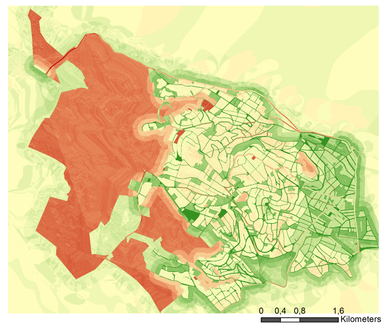
One of these spatial analyses is the multi-criteria analysis. With this unique capability, GIS reveals deeper insights into data, such as patterns, relationships, and situations helping users make smarter decisions.
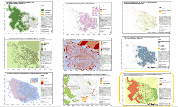
In such analysis you go through several steps to create one map that shows which areas are more and which ones are less suitable for a project according to the indicators applied in the analysis:
1. Identify attributes that you want to investigate.
2. Develop indicators that can best represent the attributes, considering also the availability of spatial data that can be used for developing the indicator.
3. Decide on the weight of each indicator in your analysis, and how important they are compared to each other.
4. Visualise the spatial indicators on different maps.
5. Overlay all the maps cumulating the values of each pixel received at each indicator.
Working this way has important benefits. It helps to make better use of people’s knowledge in combination with expert input. Decision -making is based on facts and up-to-date input from citizens. This will most likely lead to better acceptance of decisions made by the city.

Invest in civil servant’s skills
Cities put more and more effort into collecting data from citizens for their decision-making processes and project planning. For this purpose, map-based questionnaires can be helpful since they allow cities to collect large amounts of data from citizens in a standardised way.
However, such a large amount of data also means a big responsibility for city administrations to apply those data, making people’s knowledge count and turning them into real planning outcomes. For this purpose, even better use can be made of GIS analyses, which cities can use to extract the main information from the big data. However, implementing GIS analyses requires both GIS expertise and GIS software.
Looking at the benefits for citizen participation, it is worth investing in both! To create this expertise, it is strongly advised that the technical skills of civil servants be improved. This will make them confident to apply digital tools for citizen participation such as map-based questionnaires, GIS-related tools, and software.
Cities that wish to make serious progress in citizen participation through investing in their organisation and the abilities of the civil servants to work with citizen participation should therefore also look at this when deciding on training the skills of their co-workers.

