Densification of urban areas beyond the core of the cities is not an easy task but it is a challenge worth taking to fight against urban sprawl.. City centres, which are usually already dense and mostly regenerated, are surronded by transitional belts (sometimes called fringe areas) which have diverse urban functions with lower density, offering in principle good opportunities for densifying interventions towards the aim of compact city development. However, the task is not easy at all: physical interventions to achieve environmental benefits have high risks of negative social externalities; moreover they require substantial financial means in a period when the public sector suffers from the consequences of the financial crisis.
The challenges of densification are first discussed from a theoretical point of view and illustrated by city examples. Then the approach of the URBACT Action Plannig Network sub>urban is highlighted, showing innovative approaches in four of the project partner cities. Finally a snapshot is given about the dynamic way in which sub>urban is dealing with this challenging topic in transnational meetings.
The challenge of urban sprawl
Density is one of the central issues in the recent debates about the urban future. The reason for that lies in the contradiction between the private and public interests in relation to the density of urban living: most actors (households, developers, businesses, etc.) strive to increase their individual, private benefits which, however, can only be satisfied at the expense of public interests. For example, most families prefer less dense urban forms, and their dreams result in sprawling suburbs which are very harmful from the perspective of sustainable urban development.

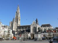
The URBACT Sub>urban network, led by the city of Antwerp, followed by the Lead Expert Maarten van Tuijl, concentrates on the urban fringe. This is defined as the often non glorious post war area surrounding the historic city, encompassing a mix of large modernist housing estates, low-density private housing, malls, logistical companies, recreational areas, businesses and industrial zones (van Tuilj, 2016). The aim of the network is to explore and compare the options to densify the urban fringe in an integrated way, taking both the physical and social characteristics into account. Densification through the „Regeneration in the urban fringe should be aimed toward mixed cultural and ethnic backgrounds and people of different incomes, education levels and ages. Therefore, the challenge also lies in spreading the benefits of growth and of regeneration equally and in providing affordable housing, jobs and facilities for all.” (ibid)
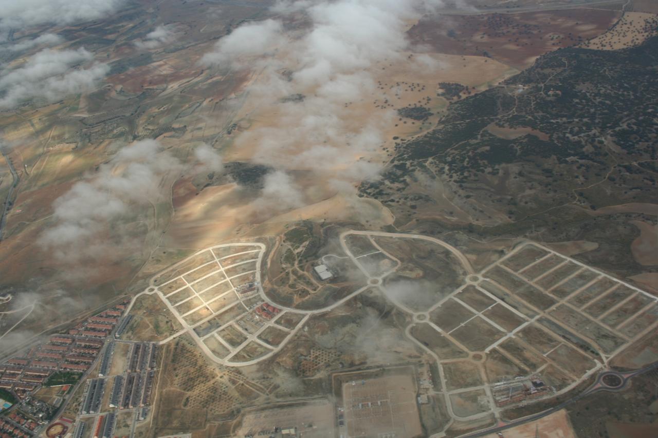
Antwerp experiences a strong population growth outside the inner city. It has selected 7 action planning areas from the large territory of the urban fringe, with very different challenges and identities. Lageweg, a formal industrial site, is one of them. The area is characterised by a high number of owners with small plot sizes. There, the municipality applies specific pilot measures to speed up the development process (van Tuilj, 2016). It organises activities such as mind opening dialogues and kick-off discussions to explore collective ambitions for the area, co-creative design tables involving an interactive scale model of different scenarios in order to build collective trust, guided walks with all stakeholders with a brochure showing possible future scenarios, adaptable spatial and financial calculation models to test the feasibility of several options. Thanks to these tools most of the land owners were gradually convinced and decided to sign a declaration of engagement to work and invest together in the project. The success of the initiative was that it allows to work across property borders and to make an effective plan for the whole area, for a step-by-step development.
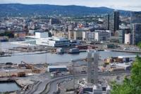
Oslo wants to solve the conflict of dynamic growth versus spatially limited urban area (the city is surrounded by highly valued green belt which can not be touched) by densifying former monofunctional industrial areas, within the city border but outside the city core. 5 pilot project areas are selected to test a new process, with the objective to make transformation more flexible. The city focuses on the essentials and leaves room for private parties to come up with their own ideas. A Planning Program defines general guidelines, urban development principles and rough parameters for land use, height and utilization (van Tuilj, 2016). This is extended by a Principle Plan for the Public Space, which defines the boundary, size and desired qualities of public spaces, identifies and describes public projects and builds in a certain flexiblity, so that market parties can fill in the rest.
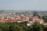
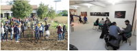
Brno has been characterized by heavy suburbanization in the last two decades. To mitigate that, the city is looking for opportunities of densification within the city border. Two action areas have been selected. They are relatively close to the city centre (10 minutes by tram). A dynamic university campus has been built in the area, which is still surrounded by little gardens. Some of the gardens are already abandoned as the owners know that the area will change: the future use will be housing – although no infrastructure and transport links exist yet. Brno municipality decided for an experimental approach instead of the usual top-down decision-making. As a first step links have been created between the relevant municipal departments, the mayor and the 3 affected district mayors. Nearby residents were waiting for the municipality’s ideas (e.g. immediate re-zoning) and were prepared to oppose these. To their greatest surprise they were approached by the municipality and asked about their ideas. This new type of planning process is unusual in post-socialist cities, it has to be explained not only to the different units of the city and district administrations but also to the politicians. The URBACT project and the need to create Local Support Group was a good occasion to start this journey towards an uncharted territory in policy-making.
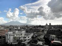
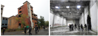
Casoria is the largest municipality in the northern Naples area, only 10 km away from Naples. The population (around 78 000) has been decreasing in the last two decades. From the late 1970s on, Casoria has lost its role as major industrial centre: production activities stopped, factories and industrial sites were abandoned. The city developed a strong services sector but today even the services sector finds itself in crisis. Local residents are leaving the area due to traffic congestion, unemployment, low quality settlements, poor quality housing, inadequate infrastructures (roads, facilities) and lack of public green space (see Sub-urban Baseline Study, 2016:95). In Casoria, the need for densification comes not from urban growth or suburbanization but from the high number of underused areas and buildings from the industrial and services sectors and from the plans of the municipality to create large suburban public parks. The city promotes flexible planning in transparent arenas, testing tactical urbanism. Instead of top-down decisions, the public administration wants to work with private owners and city users (associations). Cooperation with other municipalities is planned towards a strategic plan beyond the municipal borders.