
How to integrate ecosystem functions in infrastructure? RiConnect Lead Expert Roland Krebs reflects on the impacts of mobility infrastructure in urban climate, and on the possible solutions to mitigate the effects.
RiConnect is seeking to develop integrated solutions in metropolitan areas; one of the key features of sustainable urban development is the development of green infrastructure. Around summertime, urban heat waves are in the media, with peaking temperatures around 40°C which makes living our cities a burden.
Climate change and its implication to our lives is undeniable and a transformation towards greener cities must start now. Metropolitan areas are especially vulnerable: insulation of soil is higher, green area distribution is low, there are more cars etc. For our biodiversity this has a negative impact and consequently, also to human health. A greener metropolis would provide long-term environmental and economic benefits like a better integration of the recreational areas into the metropolitan urban fabric, and a better community cohesion by articulating and activating the green assets in the metropolitan area. This would lead to a better ecosystem integrity and subsequently has health benefits for the residents of metropolitan areas.
The metropolitan area must be thought like a whole eco-system and mobility infrastructure needs to be rethought towards a more integrative element in this ecosystem. We observe that infrastructure is dominating the natural spaces. They could be restored and re-integrated into the landscape. The road or train infrastructure might disappear under the ground and the natural space rehabilitated. But also, the space underneath the infrastructure (e.g. bridges) could be opened and activated for sport or culture, a communication between the neighbourhoods would eliminate barrier effects, cohesion effects would be generated. In the long run, biodiversity will be restored, and identity through the accessibility rebuilt. However, these are mid- to long-term goals that are not easy to be financed, but certainly they enhance the quality and resilience of the environment. But, it might only take simple placemaking measures to create permeability of the barriers and open the paths that might connect neighbourhoods in a fragmented metropolitan area.
In the core of the solutions towards green metropolitan areas are the so-called Nature Based Solutions. It is about the implementation of projects that will not harm the environment or minimize the negative impact of those implementations. While building new infrastructure, the protection, restoration, and maintenance of the ecosystem is key to the success. In order to fulfil the vision of a sustainable metropolitan area, the protection of the biodiversity and human wellbeing is key. The metropolitan areas will be improved by reducing the greenhouse gas emissions through creating denser settlements, and reducing car traffic through mixed-use patterns and efficient public transport. Keeping nature clean means to provide benefits in the long term.
The key to success is the combination of a set of integrated measures and actions to create a sustainable and eco-friendly urban development. As a rule, single actions might not be effective, combining one or several measures would be more efficient. Some of the key performance indicators are:
- Dense Settlements and mixed-use patterns, avoid traveling in the metropolis
- Heat Island Effects in metropolitan areas
- Un-sealed parking lots
- Consumption of agricultural land
- Food production in the metropolitan area
- Effective Public Transport as an alternative to individual cars
- Creation of hubs in the metropolitan area
- Green Facades of Buildings
- Greening the Infrastructure hubs
- Activating obsolete infrastructure with green elements and parks
- Add value to mobility infrastructure with recreational activates like running tracks, bike corridors along the infrastructure
Let me pick one essential indicator for ecosystem functions in metropolitan areas. Urban heat islands are troubling metropolitan areas more and more. Heat waves during summer days and nights make living in the city uncomfortable. The green area distribution is not well developed, larger green infrastructure like cooling parks is not available. Microclimate simulations would help to improve performance of the urban interventions during the urban design.
For example, the City of Vienna together with the National Railway Company (ÖBB) is developing a 9-ha inner city brownfield project called “Neues Landgut” in the 10th district of Vienna, next to the Main Train Station. The site is heavily affected by the heatwaves that come from the train tracks that are located along the south-western border of the perimeter. The former logistic site has not a single tree, a reduction of negative externalities must be found. Now, the city agreed with ÖBB that each real estate project - 90 % of the area will be residential, 4500 new residents will live there - has to perform a micro-climate simulation and quality control with the following parameters:
- Min 20 % of façades of buildings have green elements, balconies delivered with installed irrigation
- Green Roofs and photo-voltaic system
- Inner courtyards of blocks with trees
- Improved performance of trees (shadows) in the park
- Active terraces on buildings available for the residents (create decentralized active green)
- 4 m2 per new resident of usable public park and green areas
- Public spaces have to provide permeable features, e.g. follow the sponge-city approach
- Mixed-use with library and educational campus (primary and secondary school + music school)
- Active ground floor zone with 2.000 m2 leasable area to create a new commercial hub with shops and workplaces
- For 30 m2 of net residential area 1 parking space for a bike, one third available in the ground floor zone.
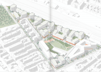
Figure 1: Masterplan Neues Landgut in Vienna. Source superwien
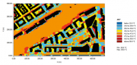
Figure 2: Heat Island Maps to improve performance of green areas. Source: Greenpass
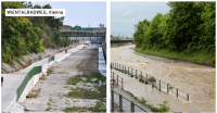
Another interesting project is the construction of a bike-highway along the river “Wien” in Vienna. Due to the lack of bike infrastructure in the west of the city of Vienna, the administration decided to activate the riverbed and bank of a river. Today the new infrastructure is very well used; even cultural events are conducted in the riverbed. The project has several functions and demonstrates how integrated ecosystem functions could work:
- Flood-control during floods
- Bike Lane of 7 km with 10 entrances and 2 emergency exits
- Link to important transportations hubs and cycle routes of the city and metropolitan area
- Seasonal opening, according to the situation of potential floods
- Recreation attraction and linear park for walking, runners, bikers and commuters into the city centre.
|
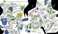
The RiConnect Chronicles 06: Thematic Meeting 3 The integration of ecosystem functions within infrastructures is a major concern for RiConnect. Consequently, the topic was widely discussed at the RiConnect Transnational Meeting 6, celebrated online in April 2021. A summary of the discussion is available at The RiConnect Chronicles 06, a record of events in the order in which they occurred, to highlight the most relevant ideas to the topic dealt with during this meeting.

|
Figure 3: A metropolitan bike lane along the Wien river in Vienna. Source: City of Vienna
Roland Krebs is the Lead Expert of the RiConnect network. He is an Urban planner and urbanist, and director of Superwien urbanism, where he develops strategic action plans for cities to tackle urban growth. He has a vast, international experience in urban planning, design and development, real estate development, land use planning and regional planning.
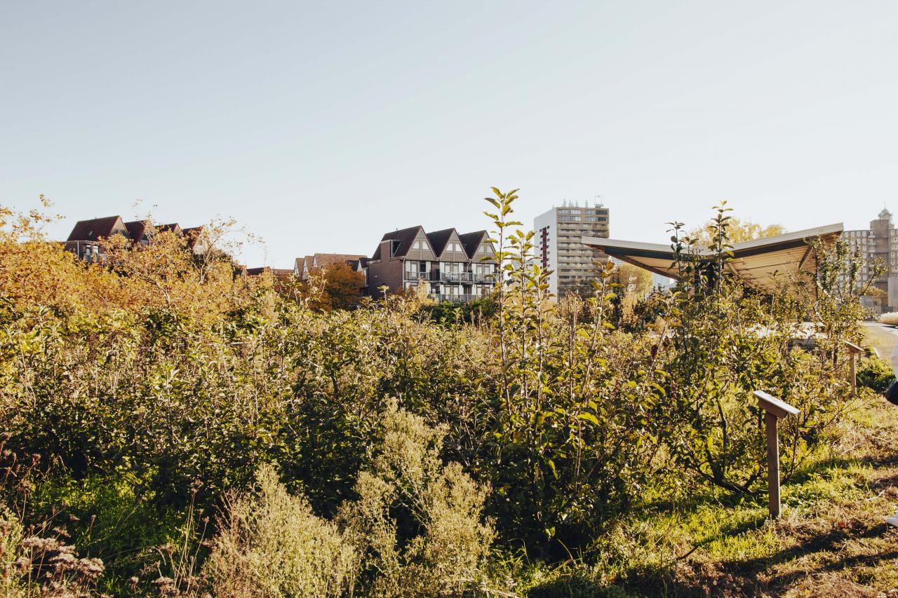
Cover image: green areas on a former rail viaduct in Rotterdam. Source: Stela Salinas, RiConnect Communication Officer.